Applied Seismics
An important task of geophysics is the investigation of the subsurface, carried out with physics-based methods, in order to obtain information on both the structure of the earth's interior as well as its physical properties. This information has significant value for a large variety of applications. For example, research on the planetary development depends on detailed structural information, as does, e.g., carbon hydrate exploration, CO2 sequestration, or the investigation of potential geothermal energy reservoirs.
While it is possible to obtain such information by drilling boreholes down to depths of several kilometres, such measurements provide only punctual information, while the methods of applied seismics allow to image larger regions, including greater depths, and to extract elastic properties like densities and propagation velocities of elastic waves.
In an active seismic experiment, seismic waves are generated at the earth's surface with 'artificial earthquake sources'. The waves propagate into the subsurface with a velocity that depends on the material. When such a wave encounters a structure where the elastic parameters, e.g., the density or propagation velocity change, a fraction of the wave energy is reflected or scattered. Subsequent processing of the reflection echoes measured at the earth's surface allows to reconstruct an image of the subsurface.
Another important field of work in applied seismics is the investigation of so-called acoustic emissions, earthquakes with very small magnitudes that can be man-made or natural of origin, with seismograph networks with dense coverage. Observation of acoustic emissions is a significant means for the monitoring of the subsurface for potential dangers like sinkhole collapses, landslides, and other tectonic events.
As the structure of the subsurface can be very complex, its reconstruction or the localisation of acoustic emissions can, accordingly, be very demanding. The Applied Seismics group of the Institute of Geophysics at the University of Hamburg has therefore gained international recognition for our development of new methods for seismic subsurface imaging and the localisation and characterisation of acoustic emissions.
In the following, we present our group and a selection of our current research projects:
Examples of our current research:

Determination of common reflection point trajectories
O. Bölt (2020)
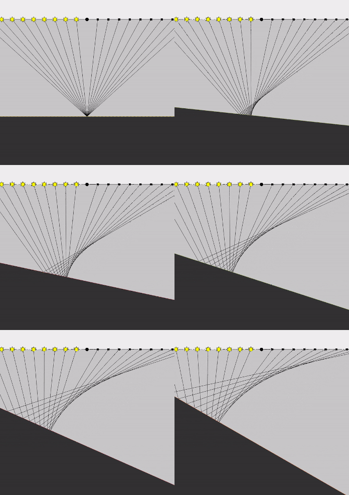
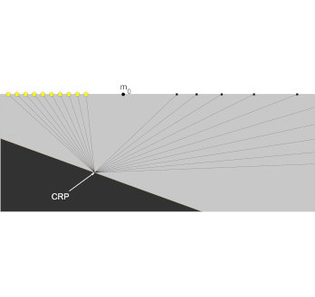
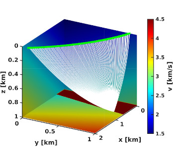
The gathering of reflections originating from a common reflection point (CRP) is an important step in seismic data processing. In the case of a horizontally stratified medium, this can be achieved by using common midpoint (CMP) gathers. If a CMP-gather is used for inclined or curved reflectors, the reflection points are dispersed over the reflector due to Snell’s law. This introduces an error to further processing of the data.
To avoid this, a CRP-gather can be used, where each source-receiver pair is described by its own midpoint and half-offset. In our work, an analytical expression for calculating these midpoints is assessed using the NORSAR ray tracing software.

Denoising migrated seismic images
M. Glöckner (2019)
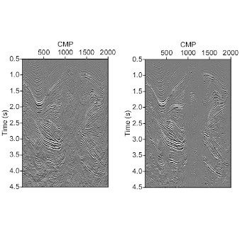
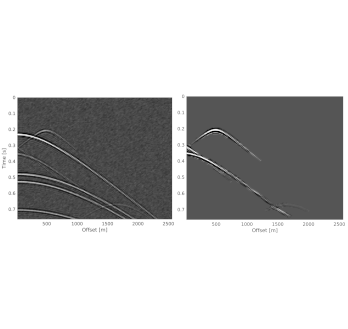
In recent years, deep learning algorithms have become more and more popular in interpretation of seismic data. In seismic processing however, these algorithms are only starting to be considered. The potential of artificial intelligence and machine learning is currently not fully exploited. One important aspect seismic of processing is data denoising. Autoencoders are deep neuronal networks that inherently denoise and are widely used in many different fields. They aim to find a function that maps data A to data B. We apply the autoencoder as migration deconvolution operator to approximate the inverse Hessian of a least-square approach to obtain an improved migrated image. We use time-migrated and remigrated images, where the remigrated image is obtained from migrating of demigrated data, to train an autoencoder. The remigrated data serves as input (data A) and the migrated data is the target output (data B). The autoencoder contains several layers of convolutional filters and data reductions. The trained network can be used for improving the migrated image (left image in figure). Furthermore, the inherent behaviour of the autoencoder leads to a decreased signal-to-noise ratio, since unimportant aspects of the data are neglected in the data reduction process (right image in figure). The autoencoder is able to denoise the image and remove imaging artifacts without compromising seismic events.

Unsupervised seismic interpretation
J. Walda (2019)
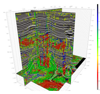
Machine learning, in particular deep learning, has become a vital factor in pattern recognition and repetitive tasks, often outperforming humans. Seismic interpretation is often associated with finding specific patterns of interest and can depend on the interpreters involved. We aim to provide consistent automatic interpretation of specific data, that assist interpreters. In order to do so, we combine deep learning with traditional machine learning techniques for automatic interpretation of seismic attributes using 3D data of the F3 block, offshore Netherlands and the Volve Field. A major difficulty of seismic interpretation is the way of dealing with the richness of seismic attributes, which results in a multidimensional problem in interpretation. Usually, the amount of seismic attributes is reduced, e.g. by principle component analysis, before interpretation. In order to analyze the most important spatial information from two sets of attributes containing six attributes each, we use a 3D convolutional autoencoder. The autoencoder aims to find a reduced representation of the data. To verify, whether the found representation is reasonable, we reconstruct the original data and evaluate the misfit of reconstructed and original data. Once the misfit is sufficiently small, we cluster the reduced representation (encoding) to obtain a feature cube that contains a label for each sample. This process reduces the multidimensional information of multiple seismic attributes and their spatial distribution to one label for each sample in the 3D spatial volume. The found labels can be interpreted instead of the numerous seismic attributes, which eases and accelerates interpretation and reduces cost. Furthermore, human interpreters might overlook features of interest in the seismic attributes, which can be revealed by our unsupervised deep learning approach.

Identification and focusing of edge diffractions
P. Znak (2020)
Imaging of the Earth's interior can be seen as a process of reverse time seismic wave propagation and focusing. By forcing scattered waves to focus, geophysicists simultaneously localize heterogeneities and improve their understanding of the subsurface model.
A point diffractor acts pretty much as a buried point source and thus the point diffractions can be focused directly. However, more often in practice, we deal with waves diffracted by extended edgy structures (faults, highly curved folds, cracks, etc.). In our recent studies, we figured out how to utilize local properties of the edge diffraction wavefronts (wavefront curvatures) to pick the focusing rays without any assumptions on the subsurface model.

Velocity model building with diffractions
A. Bauer (2020)
The diffracted wavefield measured at the Earth's surface is a rich source of information, because diffracted waves are excited by subsurface heterogeneities smaller than the seismic wavelength. Since diffracted waves do not obey Snell's law but are scattered into all directions independent of their incidence angle, they illuminate large portions of the subsurface. In seismic data, the diffracted wavefield is often masked by higher amplitude events such as reflections. However, it can be accessed by modeling and adaptively subtracting the reflected wavefield or by making use of specific properties of diffracted waves.
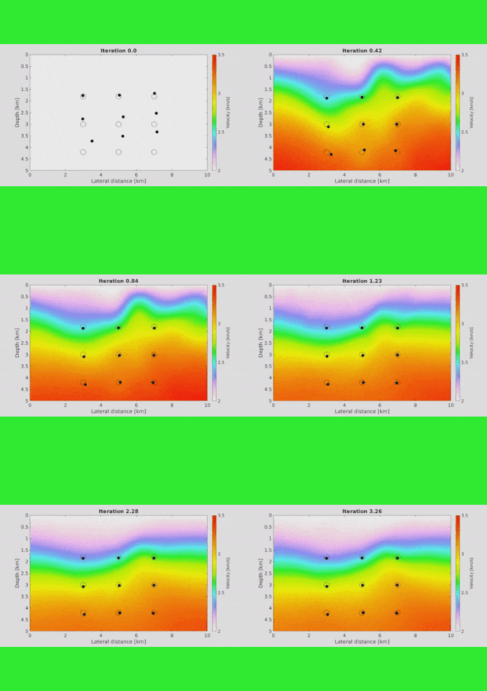
By means of coherence analysis, wavefront attributes that encode information of the measured diffracted or reflected waves can be extracted from the data in an automated fashion. We use these wavefront attributes for depth-velocity-model building with wavefront tomography. Our applications focus particularly on data with none or few source-receiver offsets, where conventional tomographic methods are not applicable, such as low-fold academic data, passive-seismic data or ground-penetrating-radar (GPR) data. For this kind of data, diffraction wavefront tomography is a powerful tool, which not only provides a depth-velocity model, but also a localization of the scatterers.

Diffraction processing using machine learning
S. Knispel (2020)
Machine learning, or deep learning, in applied seismics has recently been applied mainly in seismic interpretation. Whereas the utilization in processing would also be beneficial and could change the whole approach to seismic data processing in the future of applied seismics.
Diffracted acoustic or elastic waves are generated by geological structures in the subsurface smaller than the dominant wavelength, which allow the high resolution of seismic data. We intend to extract and amplify diffractions, before common known seismic processing steps, in the shotgather domain. For that, a 2D convolutional autoencoder is used to classify a shotgather pixel by pixel into diffractions, reflections and noise and exploit the found labels to extract diffractions. Furthermore, by using their kinematic properties, the cross-correlation and more deterministic steps help to amplify the already extracted events and to get rid of artifacts caused by high amplitude reflections. Besides, as a by-product, it is even possible to separate single events.

Identification of point and edge diffractions for an improved assessment of tectonic overprint and fault interpretation
S. Dell (2020)
A modified Kirchhoff time migration is used as diffraction imaging tool. The reflection response occurs as a local spot on the Kirchhoff operator surface. A point diffraction occurs as a diffuse signal all over the Kirchhoff operator. The edge diffraction can be seen as a mix of a reflection and a point diffraction. On the migration operator surface it should show a response within an azimuth sector. The azimuth determines the local orientation of a fault to the acquisition line. The triality of the seismic response allows to isolate reflections, point diffractions, and edge diffractions.

Seismic event characterization in sparse and limited-aperture network
P. Yang (2019)
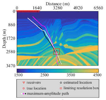
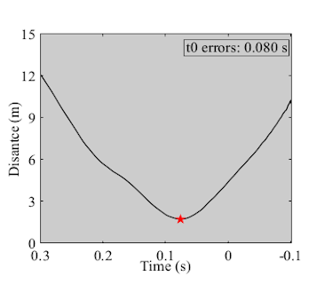
Time-reversal is a very common tool for estimating seismic event which is essential in monitoring as it can provide valuable information of the seismicity induced by anthropogenic activities, such as in hydraulic fracturing monitoring. However, this technique needs sufficient illumination of back-propagated wavefields for identifying seismic event, which is not often realized in practice because of sparsity and limited aperture of seismic stations. In our recent research, we figured out a new approach based on maximum-amplitude path which can estimate source excitation time and locate passive source simultaneously in sparse and limited-aperture network.